
Special course: Spatial data science for sustainable mobility deals with the use of spatial data science approaches to study sustainable mobility and accessibility in urban environments.
After participating in the event, the student is able to:
Understand how human well-being and capabilities relate to mobility, and how those can be analyzed using computational approaches
Use open-source spatial analysis libraries to study spatial mobility and accessibility
Understand how modern computational technologies can be used to support open science and reproducible research
Assess the selected analytical tools and understand their benefits and limitations
Course format#
The majority of this course will be spent in front of a computer writing code with the Python language. Most exercises in this course involve real world examples and data. For each exercise, you may be asked to submit the Python codes you have written, output figures and answers to related questions.
Interactive contents
Each lesson in this course can be turned into an interactive programming session in the browser. You can find buttons for activating the python environment using Binder at the top of each programming lesson.
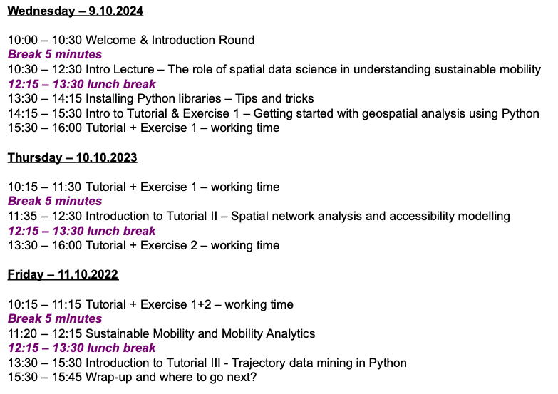
Program#
The planned program for the course:
Looking for earlier versions?#
This website is a living document that changes slightly each time I teach these materials. However, all the earlier versions of the site are available from here:
Contents#
Course information
Presentations
Tutorials
Exercises